YellowFin Raster Maps
Completed
Customer wants a Raster Map of a Warehouse to show Measures for each Location
The Raster Map is 1100 * 300 Pixels with over 3500 Locations on it
Worked a treat - see a small section (screen shot) of the whole below showing different sized Locations and Utilisations for those Locations
Yellowfin Mapping is the best there is (try doing this using anything else this easily)
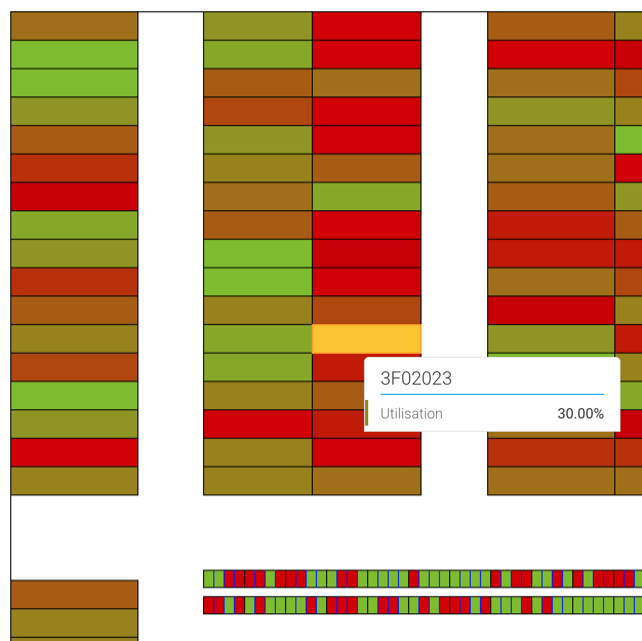
Raster Map generated using a C# .Net Application
Reference Code Image Map Zones created using SQL
Reply if you're interested
 I like this idea
Hi Mark,
Thank you for reaching out. I'm happy that you're happy with Yellowfin's Mapping, but I'm not quite sure exactly what is being asked or offered here. If you'd like to clarify I'm all ears!
Regards,
Mike
Hi Mark,
Thank you for reaching out. I'm happy that you're happy with Yellowfin's Mapping, but I'm not quite sure exactly what is being asked or offered here. If you'd like to clarify I'm all ears!
Regards,
Mike
Hi there
Yes - you need a new category - Praise
Just wanted to let everyone know how great YF is at doing something we havent seen anything else capable of doing (at least as simply)
We managed to provide a Heat Map for a Warehouse with over 3500 Locations
This isnt a request for anything - just a Thank You
Hi Mark,
Oh, sorry I misunderstood you. Thank you for the kind words! Very impressive work on your behalf. Glad you found such an awesome, unique solution! Thanks again.
Regards,
Mike
Hi Mark,
Oh, sorry I misunderstood you. Thank you for the kind words! Very impressive work on your behalf. Glad you found such an awesome, unique solution! Thanks again.
Regards,
Mike
Replies have been locked on this page!