Raster Map only shows lowest value and code for all regions
Hi there,
In order to create a Raster Map colour coded for the 12 provinces based on their spend, I've done the following:
1. Create Org Reference for my 12 Provinces using a ProvinceCode
2. Created an SVG map and named the ID, Label & Description values for each region within the SVG file (using InkScape) according to the ProvinceCode
3. Changed the format of the ProvinceCode field in the View, to be a ReferenceCode, using my Province Reference Type
The trouble now is that in my report, all 12 of my Provinces show the same Code, Colour and Value for one specific (Northern Cape), although only Northern Cape correctly displays its value.
In trying to understand why the Northern Cape Province is the only one that is displayed, it's worth mentioning that Northern Cape's spend value is the lowest of all 12.
I cannot establish why the other 11 Provinces all show the Northern Cape code and spend value, when the actual legend at the bottom correctly displays the range all the way up to the highest spend value.
 The same question
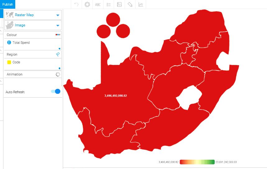
Hi William,
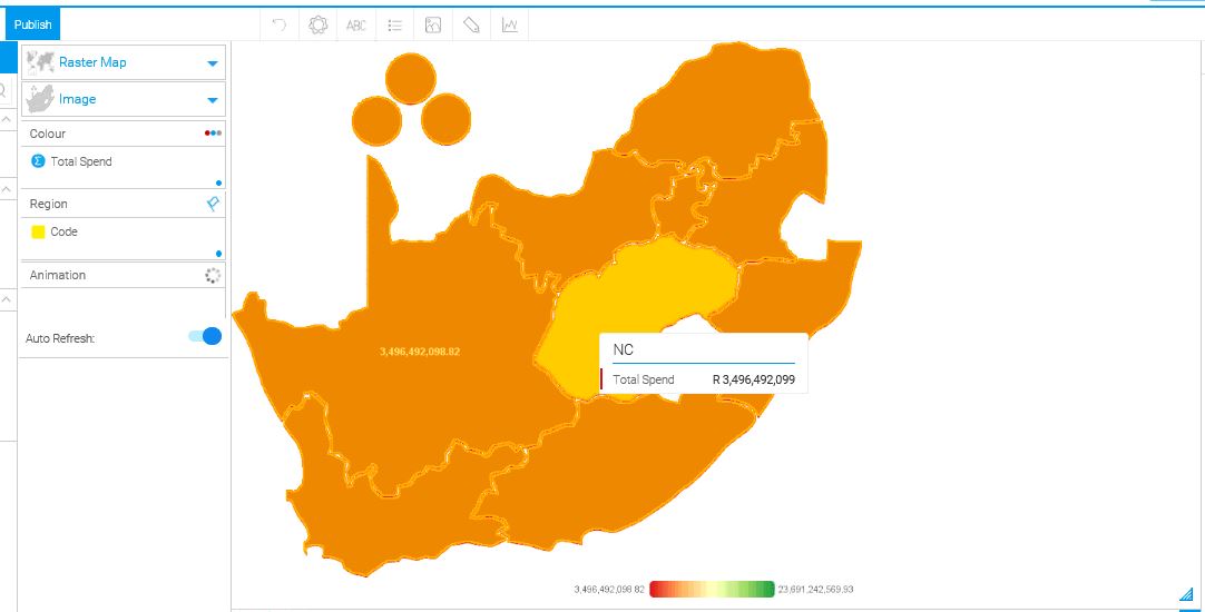
You didn't assign any colours to the map regions, please see the wiki link below for more information about it:
http://wiki.yellowfin.com.au/display/USER74/Raster+Map#RasterMap-AssigningColourstotheImage
Please let me know how you get on with it.
regards,
David
Hi William,
You didn't assign any colours to the map regions, please see the wiki link below for more information about it:
http://wiki.yellowfin.com.au/display/USER74/Raster+Map#RasterMap-AssigningColourstotheImage
Please let me know how you get on with it.
regards,
David
Replies have been locked on this page!